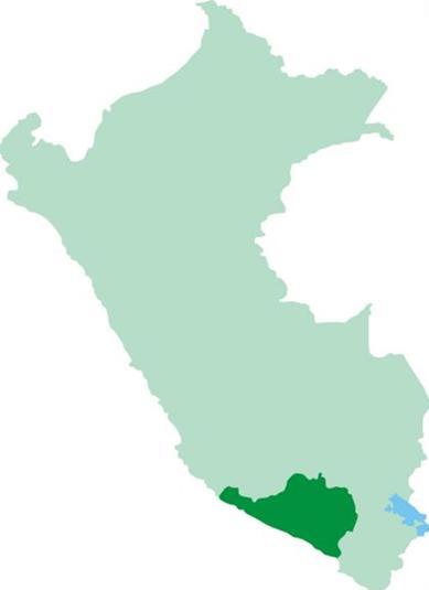
Location
The Arequipa Peru Map will help you to know about where is situated this beautiful city in Peru Arequipa is Located south of Peru, its name comes from the Quechua according to some authors “Ari – to – pay” which means “if you hold fast.” According to other authors come from the Aymara name “Ari – qquepan” whose Spanish translation would be “trumpet sound”.
Its territory comprises parts of the coast and inter-Andean. Its boundaries are: north, the departments of Apurimac and Cuzco, for this, the departments of Puno and Moquegua in the south, the Pacific Ocean and west, the departments of Ica and Ayacucho.
Its surface area is approximately 63,528 km2.
Altitude: 2.335 m.s.n.m.
Distance: 1003 km. Lima.
148 km. Colca Valley.
270 km. of Tacna.
Population: 619.200 inhabitants (City)
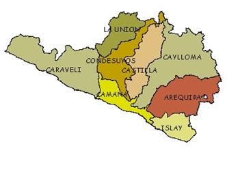
Political Division
*Arequipa, Arequipa Capital
*Camana Camaná capital
*Caravelí Capital Caravelí
*Castilla, capital Aplao
*Caylloma Chivay Capital
*Condesuyos, Capital Chuquibamba
*Islay, Capital Mollendo
*The Union, Capital Cotahuasi
Arequipa Peru MAP